Author
Message
Indy
Posted: Sat Jun 18, 2005 12:10:12 am
![]()
Site Admin
Joined: 15 Jun 2005
Posts: 2316
Location: Indianapolis, IN
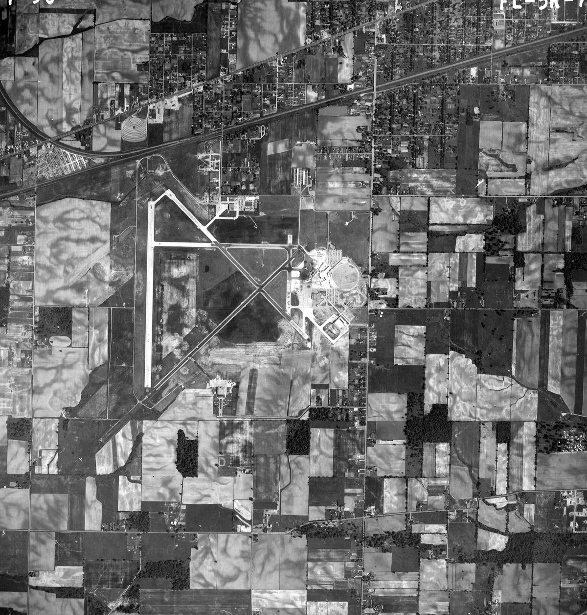
Does anyone here recognize this picture? I was digging around the net and found this.

Attached File: old-ind1956.jpg
Food4Geeks.com - Even Geeks Like To Eat.
FXIndyA380
Posted: Wed Jun 22, 2005 03:31:38 pm
Member
Joined: 22 Jun 2005
Posts: 22
Location:
Looks like IND well before my own time, as well as I-465 ![]()
So, no... I don't recognize it.. ![]()
Indy
Posted: Wed Jun 22, 2005 03:38:08 pm
![]()
Site Admin
Joined: 15 Jun 2005
Posts: 2316
Location: Indianapolis, IN
No cheating and looking at the file name ![]() . It is old IND from 1956. You can see the railroad tracks just north of the airport and what is Washington St. If you look at a new image you will see those features and they don't appear to have changed much in 50 years.
. It is old IND from 1956. You can see the railroad tracks just north of the airport and what is Washington St. If you look at a new image you will see those features and they don't appear to have changed much in 50 years.
But as you can see from the photo that should end noise disputes. The airport was there long before people built their houses around it. It isn't like they were there and then the airport moved in.
FXIndyA380
Posted: Wed Jun 22, 2005 04:20:38 pm
Member
Joined: 22 Jun 2005
Posts: 22
Location:
I actually saw the filename after I posted. I knew it had to be from the 50s or early 60s, because I'm pretty sure I-465 wasn't built until like 1964 or so. ![]()
duck
Posted: Wed Jun 29, 2005 11:34:09 pm
Member
Joined: 21 Jun 2005
Posts: 28
Location: Indianapolis
man thats crazy. what is the long runway running directly north and south? when was that demolished? I recognize 13/31 and the old runway thats now in between the parallels. there are also two facilities, north and south, that are directly across the airflield from each other, any ideas as to what those could be? does any part of the airport or terminal in that pic still exist today?
FXIndyA380
Posted: Sat Jul 02, 2005 12:39:44 pm
Member
Joined: 22 Jun 2005
Posts: 22
Location:
man thats crazy. what is the long runway running directly north and south? when was that demolished? I recognize 13/31 and the old runway thats now in between the parallels. there are also two facilities, north and south, that are directly across the airflield from each other, any ideas as to what those could be? does any part of the airport or terminal in that pic still exist today?
Not sure what the facility to the south is (though it looks like it may be some sort of farm facility), but the buildings to the north are likely the old maintenance hangars. This photo was from 1956. The airport was known as Weir-Cook Municipal Airport from 1944 until 1976, at which time it was recognized by IATA and became 'Indianapolis International Airport.'
I believe the airport was redesigned and rebuilt/expanded in the late 60s or early 70s. The only runway still standing from that picture is 14/32 (the one that runs NW/SE directly behind the current terminal building). None of the current runways intersect.